It has been an eventful week. I had a computer die at the beginning of the week, and then homecoming ended the week. Homecoming just forced me to avoid Facebook as I was not present, and the jealousy was very high.
Anyway, here is what I have to present today. (Click on the pics. The Willard Field photo was scanned very high res for you.)
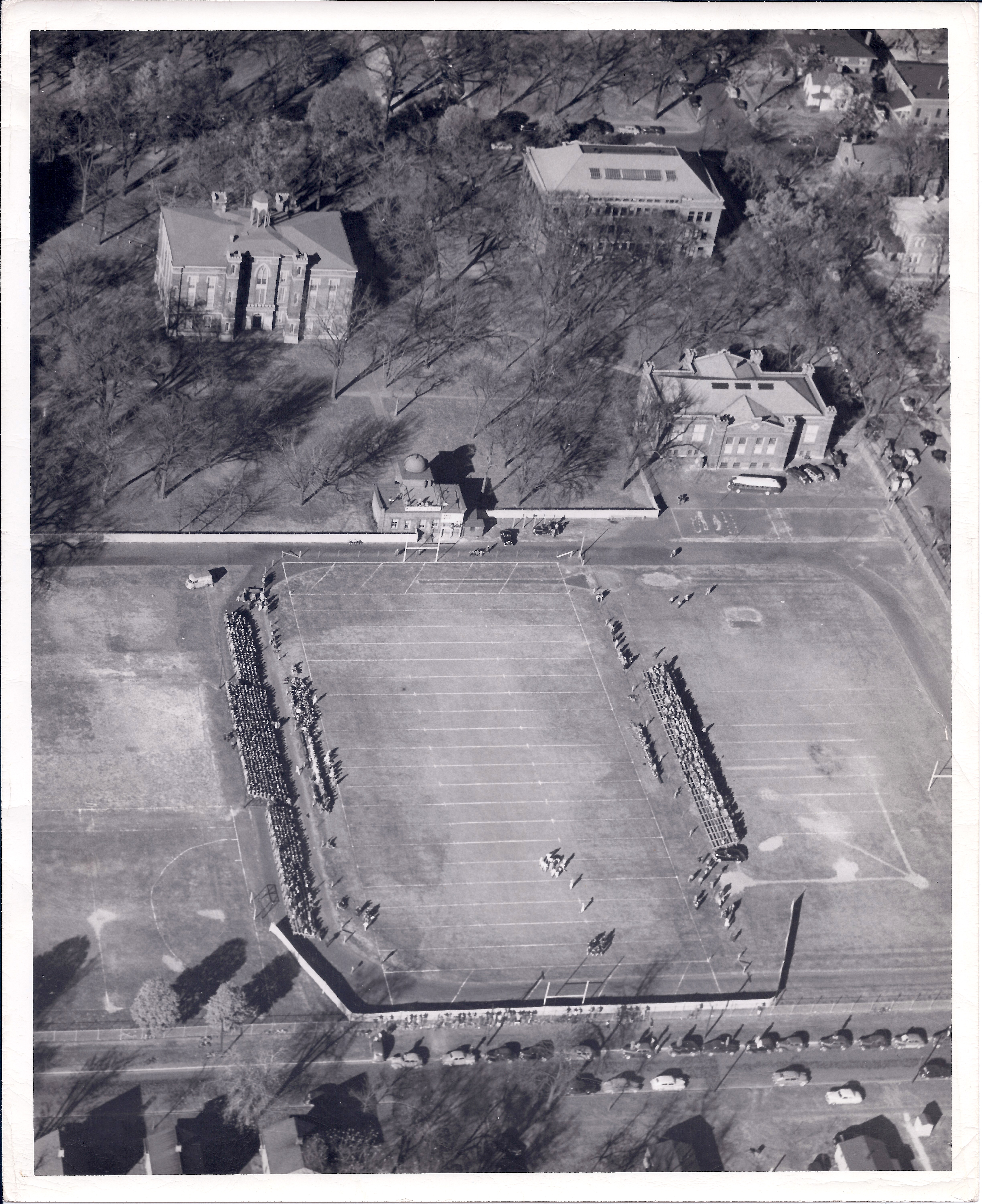
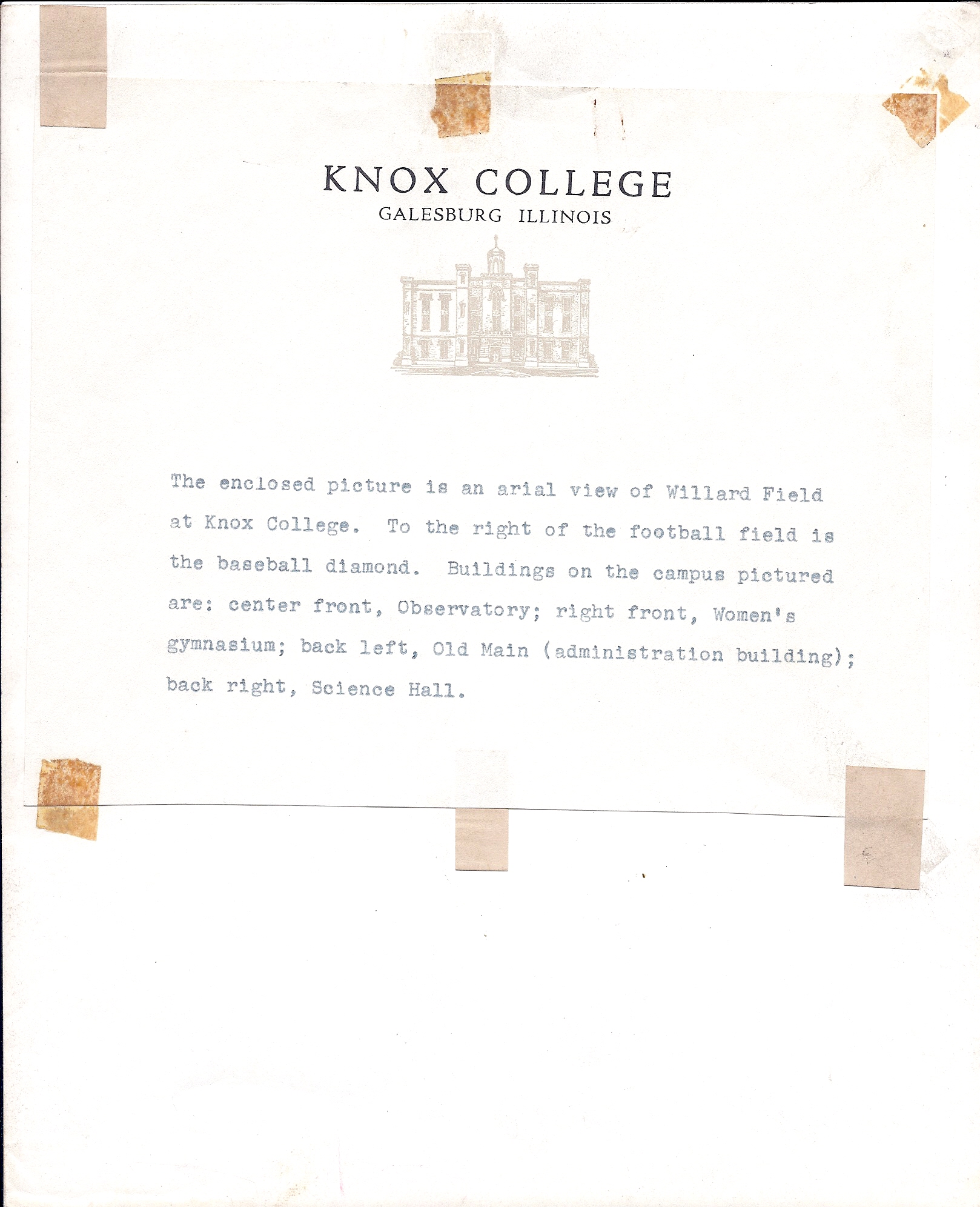 This is a 1960’s ish aerial photo of Knox. It is an official press release photo, as indicated by the official letterhead taped to the back describing it. The official description says it is of Willard Field (the first incarnation of Willard Field) but I saw something much more interesting in it.
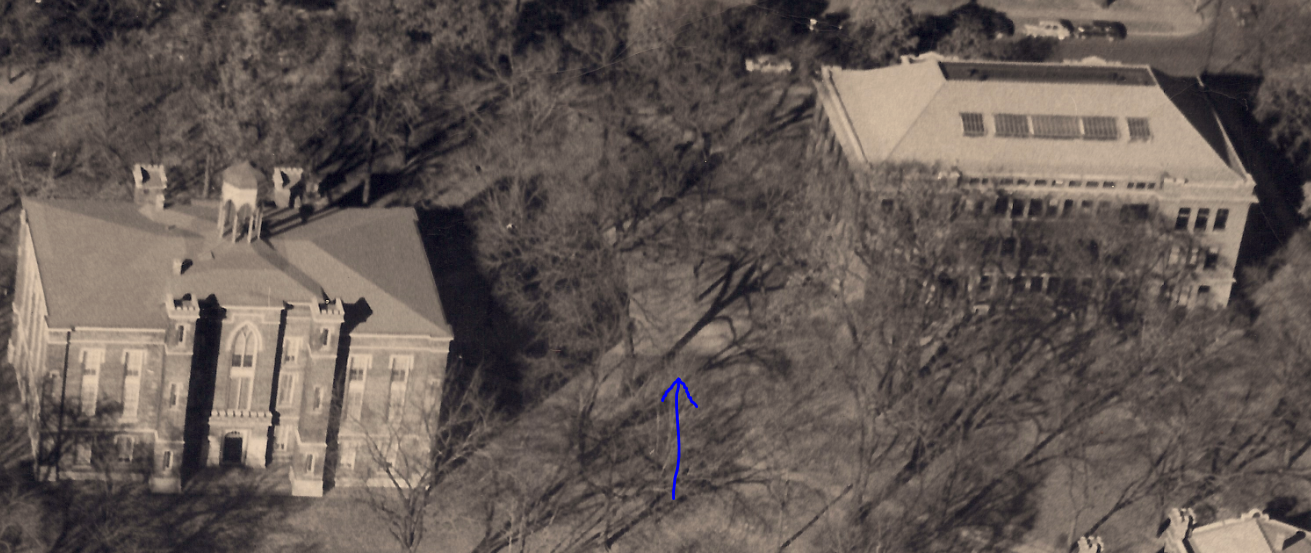 I even marked it with a blue arrow. See that little odd shaped foundation there? None of us who graduated in the 1980’s or 90’s ever saw that foundation. But on the right day in the Spring as the grass was growing, we could see an outline in the grass where it just didn’t grow as tall.
That is the foundation of the East Bricks, one of the two original dorms at Knox. The West Bricks was torn down to build Alumni Hall, but the East Bricks lived on longer.
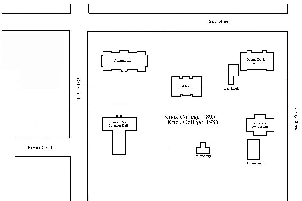
Even cooler, this photo means the work I did with Sanborn Insurance maps was spot on. 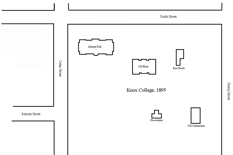
You can see in this 1895 map that the foundation is exactly where the Bricks was located. I am curious as to the shape difference between the picture and the map, however. The Sanborn maps were very precise, detailed, and drawn to scale. With all the morning shadows of Old Main and the trees, however, it is hard to determine exactly what is the shape.
In addition, the parking lot behind the Auxiliary Gym is where the Original Gymnasium was located. That is a very interesting story too. I have not told that story yet.